
Well, it’s been a bit of a break in blogs, hasn’t it? It’s taken a pandemic to force me back to writing on here… We do hope everyone is staying well and safe at home – worth reiterating, please do follow all government advice
to ensure we protect as many people as possible.
However, I promise we haven’t been idle in the absence of posts! Those of you who get the project newsletters (sign up here) will be aware of the various training sessions, mapathons, ecological works, public talks, and field checking sessions that we have been running in the mean time! We’ve had a great time meeting groups of you at talks and training sessions. Sadly the coronavirus pandemic has of course forced us to cancel our public events.
However, one thing that isn’t affected by the shut-down is our ability to continue work on the LiDAR Portal! Now is a great time to jump back in if you’ve been away for a little while, as we continue to push up our number of sites found. It has been just over 6 months since we launched the Portal, and in that time you have recorded nearly eight thousand records!
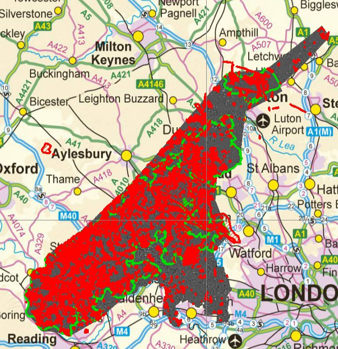
Image copyright Chilterns Conservation Board; basemap © Crown copyright and database rights 2020. Ordnance Survey Licence no. 100044050.
Over the last couple of months we have begun testing and using the “Review Portal” – this is the second phase of the citizen science LiDAR project, which I first posted about on the portal blog back in October. As always with the development of new and quite complex systems, we’ve had our fair share of teething issues, but we think we have a stable system now which allows us to start to work through all of your citizen records, assess them, and with a little bit of archaeological detective work, create records in our higher level master database. With a surge in recording activity in the last few weeks from around 30 Reviewers, we now have nearly 1000 records already added to our “master database,” and hopefully that number will continue to elevate swiftly.
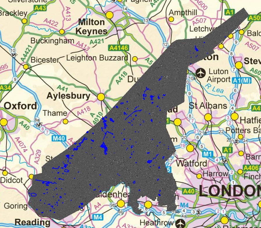
Image copyright Chilterns Conservation Board; basemap © Crown copyright and database rights 2020. Ordnance Survey Licence no. 100044050.
You may notice some small changes now on the Citizen Portal – if you hover over the tab in the top right that says “Hi [your username]”, you will see the option to visit your “My Account” page. Here you can see some statistics on your time on the portal, how many records you’ve found, and your “badges” for the work you’ve done… (if you want to print these out and sew them onto your jumper, be my guest). Underneath these you can see a table of all of your records, along with the outcome of their review once they’ve been reached in the system.
We’re keen for more people to come and join our Reviewers panel to help make those decisions and create our master database records. Sign up for one of our remotely delivered “Improving LiDAR Interpretation” workshops to get a taste for how you can draw information from the LiDAR and other datasets, and hopefully this will spur you on to join a Review Portal training session – learn how to do a bit of GIS in our bespoke system. Please do sign up for these sessions if this sounds interesting – we certainly need help working through all these records! I’m posting all the upcoming training sessions on the forum here.
Take care, and hope to see you on the Forums, Portal, or at a workshop or Mapathon soon!