
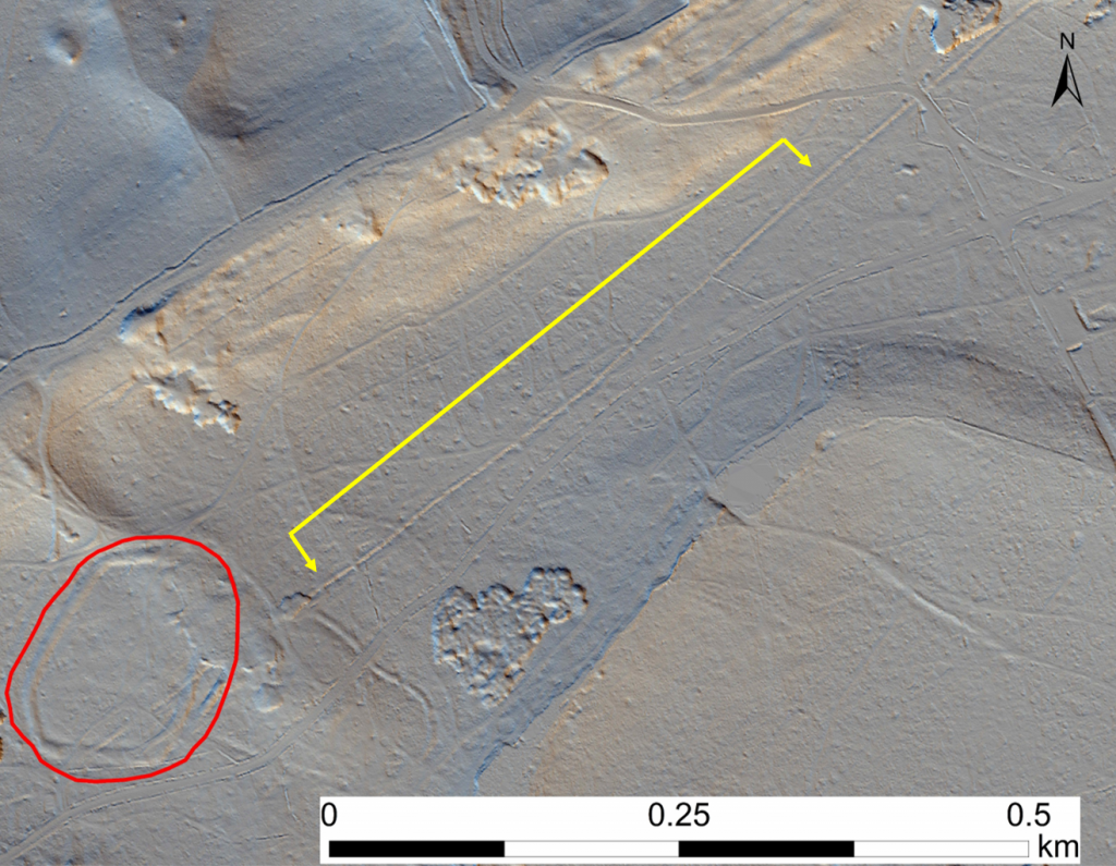
A bit of fun for this post… as you may have heard, the project has had a small excavation going on, out at Burnham Beeches, in South Bucks. We have been investigating a large, long, linear earthwork, which intersects with the hillfort, to see if we can work out what it was constructed for, and when.
If you have ever been on an excavation, you’ll know that “levels” are an important part of the recording process: the height (above sea level) of finds, soil layers, and baselines for section drawings. Knowing this information is really useful for working out the story of the site.
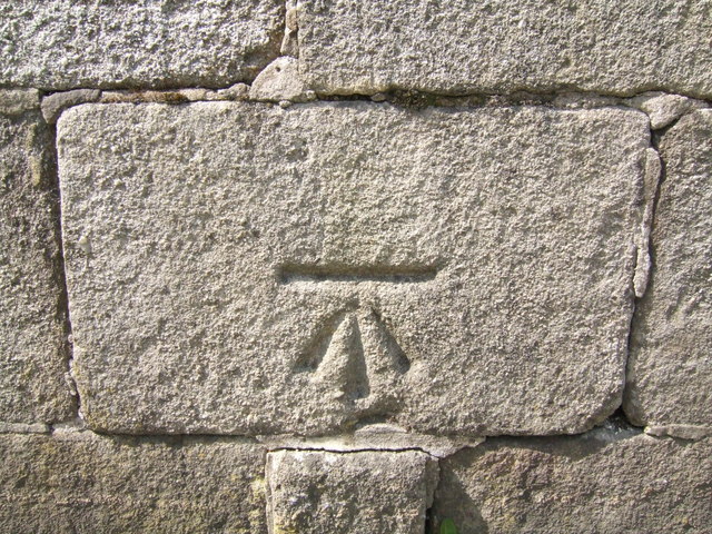
The simplest (and often most efficient) tool archaeologists generally use for this is a “dumpy level,” which measures the difference in height between itself and the object we want to survey. Given we are setting the dumpy level up and taking it down every day, and its exact location and the height of the tripod will thus vary, we use what’s known as a “temporary bench mark” or TBM, a fixed point in the vicinity of the trench, to measure the height of the dumpy level each time we use it. As long as the TBM doesn’t change, we can always work out the height of the dumpy level itself, and thus we can work out the height of anything else we want to survey. Surveyors have used Bench Marks for a long time, and you may be familiar with spotting these marks, created by the Ordnance Survey, on buildings, for just this purpose.
Siobhan Brennan-Raymond / CC BY-SA 2.0 From Wikimedia commons
So when it came to choosing our bench mark for the trench in Burnham Beeches, out in the woods, where we required a solid, memorable, un-moving point….what else were we to use?
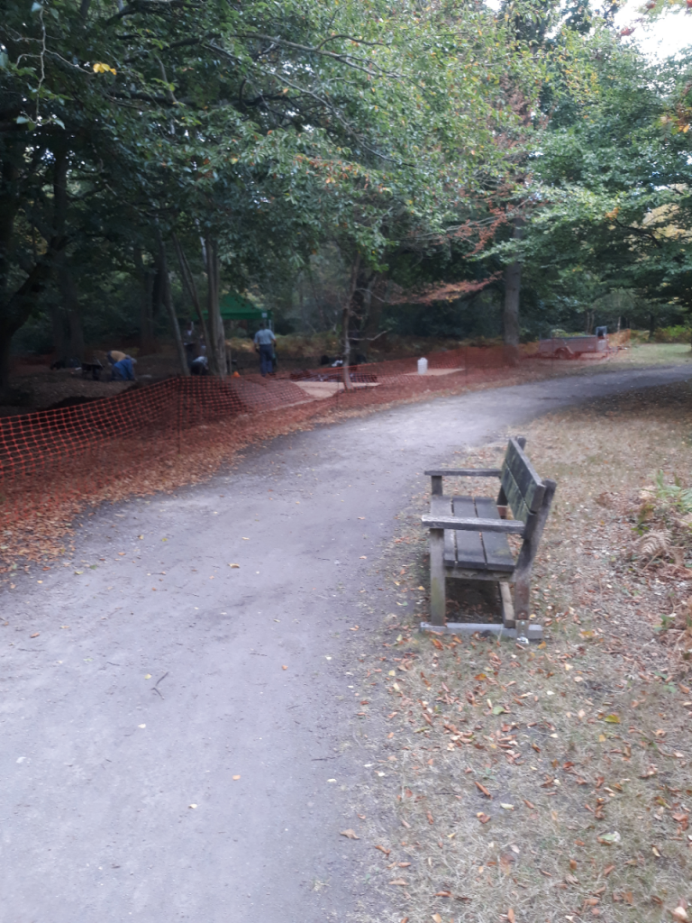
Now we’d got our fixed, memorable, un-moving “bench” mark, the next challenge was to find out its height above sea level. Normally we’d have had to get our hands on a really high quality, survey grade differential GPS system to get a good accurate height measurement… but we have another trick up our sleeves. We’ve just had a really high quality topographic survey done of the Chilterns (have you heard?!), so wouldn’t it be fun to use that instead?
In we dived to our “point cloud” to see if we could find the bench. And find it we could.
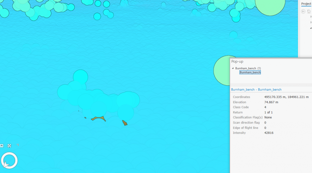
You can see that the point density wasn’t quite high enough to capture the full shape of the bench, but it certainly had a good number of points landing on the seat, which is what we needed, to show that our temporary (or indeed relatively permanent) bench mark has a height of 74.87 m above sea level. Problem solved!
As you can see, the LiDAR survey therefore has extra uses beyond simply showing up archaeological features. Being “georeferenced” to such a high precision, it also provides an excellent tool as a tether for site grids and levels, for field surveys, for topographic surveys, and many other things besides!